Construction is the world's largest industry — $13 trillion in annual spending — and until recently, also the least digitized. While finance, healthcare, and manufacturing transformed through software, construction sites largely ran the same way they did in the 1970s: foremen with clipboards, surveyors with total stations, and progress tracked by gut feel.
That's changing fast. IBEF's June 2026 report on AI and drone technology in sustainable construction — alongside new market data from Fortune Business Insights projecting the Drone Analytics market at 25%+ CAGR through 2034 — confirms that drones equipped with AI building detection have crossed from "interesting experiment" to "operational necessity."
The Three Jobs AI Drones Now Do Better Than Humans
The IBEF report breaks the construction drone revolution into three categories — and in each one, AI has moved from "assisting" humans to outperforming them on speed, accuracy, and cost.
1. Site Surveying: Weeks → Hours
Traditional site surveying requires a crew of 2-3 people, a total station or GPS rover, and days of walking the site to capture topography and existing structures. A drone with AI-powered photogrammetry does the same job in under an hour of flight time, with higher point density and fewer blind spots.
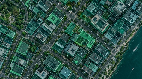
The AI layer — building detection — takes this further. Instead of producing a raw point cloud that a GIS analyst must manually interpret, AI identifies and outlines every building, foundation, and temporary structure automatically. What used to be a 2-week surveying + digitization workflow is now a morning's drone flight + afternoon's AI processing.
2. Progress Tracking: Gut Feel → Objective Data
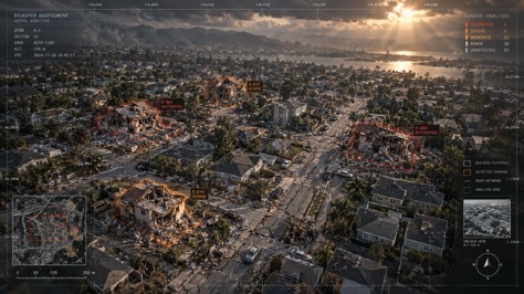
Ask a project manager "how far along is the slab pour?" and the answer is usually an estimate. AI drone monitoring changes that. Weekly drone flights capture the entire site. AI building detection compares this week's image to last week's. New foundations appear as new polygons. Walls rising from slab to roof are detected as area changes. Schedule deviations that would take weeks to notice on the ground are caught in days — sometimes hours.
3. Earthwork Quantification: Math That Actually Adds Up
Earthwork — cutting and filling soil to level a site — is one of construction's biggest cost centers and most frequent sources of disputes. Traditional methods use ground survey points and interpolation, which routinely produce 10-15% volume errors that translate to six-figure cost overruns.
Drone photogrammetry captures millions of points across the entire site. AI processes that into a digital surface model, comparing pre-excavation and post-excavation states to calculate cut and fill volumes within 1-2% accuracy. The IBEF report notes that on mining sites particularly, this precision has eliminated the "missing dirt" problem that plagued the industry for decades.
Why "Sustainable" Isn't Just Greenwashing Here
The sustainability angle of the IBEF report isn't a marketing gloss — it's a direct consequence of precision. When AI building detection and drone monitoring reduce errors, they reduce waste. Three mechanisms:
| Mechanism | How AI Drones Help | Impact |
|---|---|---|
| Precision earthwork | AI calculates exact cut/fill volumes, eliminating over-excavation | Reduces fuel use and soil displacement by 20-30% |
| Rework prevention | Weekly AI progress tracking catches deviations before concrete is poured | Prevents 10-15% of material waste from rework |
| Logistics optimization | Drone site surveys eliminate multiple inspection vehicle trips to remote sites | Cuts site inspection travel emissions by 60-80% |
IBEF estimates that AI drone monitoring can reduce construction-related carbon emissions by 15-20% on large projects — not through offsets or credits, but through the simple math of doing less wrong the first time.
Photogrammetry vs. Building Detection: Why You Need Both
A common misconception: "my drone already does photogrammetry, so I have building data." That's like saying "I have a camera, so I have a photo album." Photogrammetry produces raw 3D data — millions of points with no semantic meaning. AI building detection is what turns those points into labeled structures.
The workflow is layered:
- Drone flight → photogrammetry: produces orthomosaic + point cloud
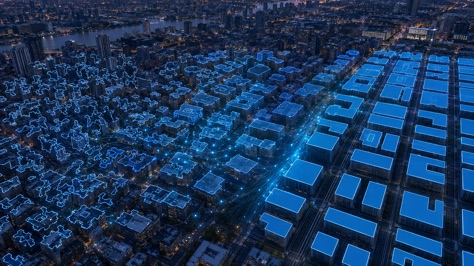
- AI building detection → semantic layer: identifies and outlines every structure
- Temporal comparison → intelligence: compares week-over-week to detect changes
Without step 2, you have a pretty 3D model. With it, you have actionable intelligence — the difference between "here's what the site looks like" and "foundation #47 was poured on Tuesday and is now 3 days behind schedule."
As we explored in our efficiency deep-dive, the AI layer is what takes drone imagery from a visualization tool to a decision-making tool.
From Megaprojects to Single-Family Homes: The Democratization Story
Three years ago, drone construction monitoring meant a $20,000 LiDAR rig, a dedicated pilot with Part 107 certification, and weeks of processing time. It was viable for airports, highways, and billion-dollar mining operations — and nothing else.
That barrier is gone. The Drone SaaS market report — published alongside the IBEF findings — confirms that cloud-based AI processing has made drone monitoring accessible to projects as small as single-family home developments. A $3,000 DJI drone and a subscription to an AI building detection platform now replaces a survey crew that would cost $1,500-3,000 per visit.
Mining leads the pack — no surprise given the direct ROI on earthwork quantification. But the fastest growth is in mid-size commercial projects ($10-100M), where the cost of a survey crew finally exceeds the all-in cost of drone + AI processing.
For construction firms looking to adopt, our comparison of drone photogrammetry tools breaks down the software landscape — though the missing piece in most comparisons is the AI building detection layer that actually makes the data useful.
The Bottom Line: $60K+ Saved Per Project, Per Year
Let's run the numbers on a typical 18-month commercial construction project with weekly monitoring:
- Traditional survey crew: $2,000/visit × 72 visits = $144,000
- Drone + AI platform: $3,000 drone + $500/month AI subscription × 18 months = $12,000
- Savings: $132,000 on survey costs alone
- Additional savings from catching 2-3 schedule delays early: typically $50,000-200,000
That's a 10-20× ROI on the AI platform subscription — and it doesn't account for the soft benefits: fewer disputes with subcontractors, better documentation for insurance claims, and the marketing value of showing clients real-time progress.
Frequently Asked Questions
Turn Your Drone Imagery Into Construction Intelligence
Upload drone or aerial images. Get accurate building footprints and automated progress tracking in minutes.
Try WetuneAI for Free →