This week, RIFFAI will take the stage at Echelon 2026 to demonstrate how satellites and artificial intelligence can identify the next generation of energy development sites. The same week, Gigascale Capital announced a $250 million climate tech fund targeting early-stage energy infrastructure. And across the industry, developers are confronting a quiet crisis: there aren't enough surveyors to evaluate the land fast enough.
The Renewable Land Rush: Bigger Than You Think
The math driving the renewable energy buildout is staggering. To meet 2030 decarbonization targets, the International Energy Agency estimates that global renewable capacity needs to triple from 2022 levels. That means finding, assessing, and permitting thousands of new sites — each requiring detailed analysis of existing structures, terrain, access, and grid connectivity.
A single utility-scale solar farm can span 500 to 2,000 acres. Before a single panel is installed, developers need to know: what structures already exist on this land? Are there buildings that need to be acquired or demolished? Where are the transmission lines? What's the terrain slope? How much buildable area is actually available after accounting for setbacks, wetlands, and existing infrastructure?
Source: IRENA Renewable Capacity Statistics 2025, IEA Net Zero Roadmap
Every gigawatt of new capacity represents dozens of individual project sites. And every site starts with the same question: what's on this land?
The Surveyor Bottleneck
If you've ever tried to hire a land surveyor for a large rural parcel, you know the problem. There simply aren't enough of them. The U.S. Bureau of Labor Statistics projects surveyor employment to grow at just 2% annually — while renewable energy site assessment demand is growing at over 30% per year.
The traditional workflow looks like this: a developer identifies 20 candidate parcels from maps and property records. A survey crew visits each one, spending 1-3 days per site measuring existing structures, documenting terrain, and photographing access routes. After 4-6 weeks, the data comes back. By then, three of the parcels have been acquired by competitors.
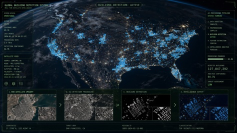
This is exactly the bottleneck that RIFFAI is addressing at Echelon 2026 — and it's the same bottleneck that AI building detection solves from a different angle. Where RIFFAI uses satellite data to identify candidate sites at the regional level, AI building detection takes over at the parcel level: given a specific piece of land, what structures exist on it, and how much of it can actually be built on?
Bold = assessable from aerial imagery with AI. Source: NREL Solar Site Selection Survey 2025.
Five of the seven top factors — land availability, terrain, existing structures, access roads, and environmental constraints — can be partially or fully assessed from aerial imagery. That's the AI opportunity.
How AI Transforms the Workflow
Picture a developer with 15 candidate parcels across three counties. Here's the AI-powered alternative:
Phase 1: Satellite Screening (Day 1)
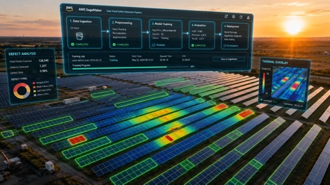
Commercial satellite imagery at 30-50 cm resolution covers all 15 sites in a single order. AI building detection processes each image, identifying existing structures, measuring buildable area, and flagging red-flag parcels — the ones with too many buildings, too much slope, or obvious wetland indicators. In one day, 15 sites become 5 viable candidates.
Phase 2: Drone Detail (Day 2-3)
A drone surveys the top 5 candidates at 3-5 cm/pixel. AI produces complete building footprint maps with area, height estimates, and roof type classification. Terrain analysis identifies optimal panel layout zones. Distance-to-grid is calculated from transmission line detection in the imagery. The developer now has survey-grade data on all 5 sites — in three days instead of three months.
Phase 3: Permitting Ready (Day 4)
The AI output is exported as GeoJSON with full attribute tables. It drops directly into the developer's GIS workflow, feeding into environmental impact assessments, zoning applications, and interconnection studies. The professional surveyor is called in only for the final site — to verify, not to discover.
Why This Matters Right Now
The timing of RIFFAI's Echelon 2026 demonstration and the $250M Gigascale Capital fund isn't coincidental. We're at an inflection point where three trends are converging:
Capital is flowing. Climate tech investment is at an all-time high. Funds are looking for shovel-ready projects, and the bottleneck between "funded" and "shovel-ready" is site assessment.
Satellite data is abundant and cheap. A decade ago, ordering satellite imagery of 15 rural parcels would cost tens of thousands of dollars and take weeks. Today, thanks to constellations from Planet, Maxar, and Airbus, it costs hundreds and arrives in hours.
AI is finally accurate enough. Early computer vision models struggled with rural buildings — barns, silos, equipment sheds — that look nothing like urban structures. Modern vertical AI models trained specifically on diverse building types now handle these edge cases with 95%+ accuracy. You can read more about how domain-specific AI outperforms general models in our deep dive on vertical AI.
The result is a capability that would have seemed like science fiction five years ago: point a satellite at a county, and within 24 hours, know exactly which parcels are buildable — with building-level detail on what's already there.
What This Means for Developers
If you're a renewable energy developer, the competitive landscape is shifting. The developers who adopt AI-powered site assessment now will close deals on prime parcels while competitors are still waiting for survey crews. Here's how to start:
1. Audit your current pipeline. How many candidate sites are stuck in the survey backlog? If the answer is more than five, you have an AI opportunity.
2. Run a pilot. Pick one pending site. Order satellite imagery, run AI building detection, and compare the output against your traditional survey. You'll likely find the AI identifies 90%+ of the same structures in 1% of the time.
3. Integrate into your workflow. The output is standard GeoJSON — it drops into ArcGIS, QGIS, PVsyst, or whatever tools your team already uses. There's no proprietary lock-in.
The renewable energy transition is the largest infrastructure buildout in human history. The winners won't be the companies with the most capital — they'll be the companies that can find and secure buildable land faster than anyone else. And that race is increasingly powered by AI looking down from above.
Frequently Asked Questions
Evaluate Your Site in Hours, Not Weeks
Upload a drone image or satellite orthophoto of your candidate site and see every building automatically detected. Free to try.
Try it for Free →