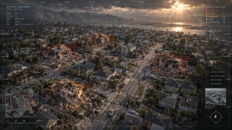
PLOS just published the most comprehensive comparison of civil infrastructure monitoring methods ever conducted. The study examined bridges, buildings, dams, and roads across four paradigms — and landed on a finding that reshapes how we think about infrastructure management: before any monitoring method can work, AI must find the structures.
This isn't a marginal improvement. It's a paradigm shift. For decades, infrastructure monitoring started with human surveyors walking sites, counting assets, and drawing boundaries by hand. The PLOS study now provides rigorous evidence that AI building and structure detection isn't just faster — it's the prerequisite for every other monitoring approach, from satellite remote sensing to sensor networks to digital twins.
The Four Paradigms: What PLOS Compared
The study's framework is worth understanding because it maps directly to how infrastructure owners think about their monitoring budgets.
| Paradigm | Method | Speed | Cost | AI Dependency |
|---|---|---|---|---|
| 1. Visual/Manual | Engineers walk sites, take notes, draw boundaries | Slowest | High (labor) | None |
| 2. Sensor-Based | IoT sensors on critical structures, continuous data | Real-time | Very high (hardware) | Low (data analysis) |
| 3. Remote Sensing | Satellite/drone imagery, periodic surveys | Fast | Moderate | Critical (image interpretation) |
| 4. AI-Powered | AI detection + any of the above, automated end-to-end | Fastest | Lowest per asset | Total (foundation layer) |
The critical insight: paradigms 3 and 4 both depend on AI structure detection as step zero. You can't monitor what you haven't located. Satellite imagery without AI interpretation is just pictures. Drone surveys without building detection are just expensive flyovers.
The Universal Step Zero: Find the Structures
Every monitoring workflow, regardless of paradigm, starts with the same question: what assets do we have, and where are they? The PLOS study quantified how long this step takes across methods — and the results are stark.
AI doesn't just win — it makes the question trivial. Four hours to do what takes human teams three months. And the AI result is more consistent: every structure gets the same detection logic, no fatigue, no subjective judgment calls about whether that shed in the corner should count.
Bridges and Buildings: Where AI Makes the Biggest Difference
The PLOS study found that not all infrastructure types benefit equally from AI detection. The biggest winners are discrete, countable assets — bridges and buildings — where the task is fundamentally about finding and classifying individual structures.
Bridges are the standout case. The United States alone has over 617,000 bridges, and 42% are at least 50 years old. The National Bridge Inventory requires regular inspection, but the baseline data — where each bridge is, what type, what it's made of — is often outdated. AI bridge detection from aerial imagery can refresh an entire state's bridge inventory in hours.
For buildings, the numbers are even more dramatic. A mid-sized city has 50,000-200,000 structures. AI processes all of them in an afternoon. For a deeper dive, see our guide to building footprint calculation for the complete workflow.
The Aging Infrastructure Emergency
This is where the PLOS study's urgency comes from. Infrastructure built during the post-war boom — bridges from the 1950s-70s, dams from the New Deal era, water systems from the early 20th century — is reaching or exceeding its design life. The American Society of Civil Engineers gives U.S. infrastructure a C- grade. The global infrastructure gap is estimated at $15 trillion by 2040.
Monitoring frequency needs to increase, but monitoring budgets don't. This is the impossible equation that AI detection solves. When the inventory step costs 95% less and runs 200x faster, you can afford to monitor more often — and catch deterioration before it becomes failure.
The PLOS study specifically flags this use case: AI can create baseline inventories from historical satellite imagery for structures that were never properly documented. Then temporal change detection tracks deterioration over time. This is infrastructure triage at scale — identify which of 10,000 bridges is deteriorating fastest, and send the inspection team there first.
What This Means for Infrastructure Budgets
Let's run the math on a typical state-level bridge monitoring program.
- Manual inventory: 5 survey teams × 3 months × $15,000/team/month = $225,000
- AI inventory: Drone flight $5,000 + AI processing $2,000 = $7,000
- Annual savings from AI: $218,000 — plus the inventory is 100% current instead of 2-3 years old
The savings compound: once you have the AI-generated baseline, each subsequent monitoring cycle only needs to process changes — new structures, demolitions, modifications. The delta detection is automated. As we covered in our AI efficiency analysis, this is where AI transitions from cost-saver to strategic capability.
Not a Replacement — a Prerequisite
The PLOS study is careful not to position AI as a replacement for other monitoring methods. Sensors are still essential for real-time structural health data. Visual inspections still catch things AI misses. Satellite imagery still provides the wide-area coverage that drone flights can't match.
AI's role is upstream. It answers the question that every other method depends on: what are we monitoring, and where is it? Without this answer, sensors are deployed on the wrong structures, drone flights miss critical assets, and inspection schedules are built on incomplete data.
This is exactly the pattern we see across industries — from construction site monitoring to solar panel inspection. Building detection is never the final answer. It's the foundation that makes every other answer possible.
Frequently Asked Questions
Start With the Foundation: AI Structure Detection
Upload drone or aerial imagery. Get precise building and structure footprints in minutes — the universal first step for any infrastructure monitoring program.
Try WetuneAI for Free →