Property valuation has always been a data problem disguised as a real estate problem. Before an assessor can value a building, they need to know what is actually there — its footprint, its floor area, its use, its condition. For decades, that data came from slow, expensive ground surveys and manual digitizing, and it was rarely up to date.
In 2026, that is changing fast. Local Logic just launched an MCP server to ground real estate AI in verified location data. JLL is pairing AI with human valuers and calling it the future of appraisal. And startups like syte are raising millions to automate the earliest, most tedious stage of real estate planning. The common thread? All of it runs on building data — and AI building detection is now the fastest way to get it.
Property Assessment Runs on Building Data
Ask any assessor what actually drives a valuation and you'll get the same answer: the building itself. Square footage, number of stories, use class, year built, condition. Everything else — market comps, depreciation, capitalization rates — is applied on top of that physical baseline. Get the building data wrong, and every downstream calculation is wrong with it.
Yet for most of the industry, that baseline has been the weakest link. It's assembled from tax records that are years out of date, from aerial photos that someone traced by hand, or from field visits that cost money and take weeks. The result: properties get assessed on data that no longer matches what's actually standing on the ground.
How AI Building Detection Changes the Equation
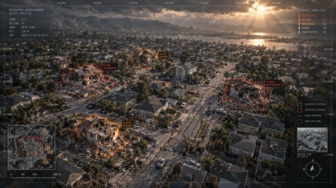
AI building detection extracts building footprints and attributes directly from aerial or satellite imagery. Feed it a city, and it returns a georeferenced map of every structure — its outline, area, and often its use and height. That single capability changes three things about property assessment at once:
- Speed. What took a field crew weeks now takes an algorithm hours.
- Coverage. Every parcel gets assessed, not just the ones worth sending a human to.
- Recency. Imagery can be refreshed regularly, so assessments track what's actually built — new additions, demolished structures, changed use.
For the first time, assessors can keep their building inventory current without bankrupting the survey budget.
From Weeks to Hours: The Data Pipeline
The time-to-data gap is the single clearest illustration of what's changed. Here's how long it takes to assemble an accurate building inventory for a typical jurisdiction under three approaches:
That last bar is why property assessment is the quiet killer app for building detection. Assessment is a mass-market, high-volume, data-hungry workflow — and AI building detection is the cheapest way to feed it.
Three Shifts to Watch
1. Real estate AI is getting grounded. Local Logic's MCP server is a signal: instead of letting LLMs hallucinate property data, the industry is wiring them to verified location and building datasets. The more accurate the building layer, the more trustworthy the AI on top of it.
2. The human + AI hybrid is winning. JLL's framing — AI plus human valuation, not AI instead of it — is becoming the consensus. AI does the grunt work of measuring and counting buildings; humans do the judgment. That division of labor plays directly to building detection's strengths.
3. Data is becoming a product, not a byproduct. Startups like syte are building entire businesses on automating the pre-planning stage that used to be manual. The building layer underneath — footprints, area, use — is now valuable enough to sell on its own.
What This Means for Assessors, Lenders, and Buyers
For assessors, AI building detection means a defensible, current inventory instead of a stale one — fewer appeals, fairer values, and less field time.
For lenders and insurers, it means underwriting on real building data: actual square footage and use class instead of self-reported figures that are frequently wrong. That tightens risk models and speeds up originations.
For buyers and owners, it means the value of a property is anchored to what's actually there — not to a tax record that hasn't been updated since the last sale. The result is a more honest market.
Frequently Asked Questions
Put Accurate Building Data Under Your Valuation
From aerial imagery, WetuneAI extracts georeferenced building footprints with the accuracy and scale that property assessment, appraisal, and lending demand.
Try WetuneAI for Free →